
Michael Ports in various roles as principal, lead designer, project director, consultant, or expert witness, has been involved in numerous water resources projects all over the world. These hydrological projects range in complexity from river training and bank stabilization works to urban stream channel restoration and comprehensive flood control investigations as well as design and statistical analysis.

Michael A. Ports with President Ma of Taiwan, when he was invited to serve as an expert for the Taiwan Environmental Administration.
As a panel member, he continues to provide independent expert peer review services in hydrologic and hydraulic engineering for multiple Hurricane and Storm Damage Risk Reduction System projects in the greater New Orleans metropolitan area. Mandated by Congress, these high-level peer review efforts are part of the process by which the U. S. Army Corps of Engineers designs, builds, and operates the flood protection system. Michael participated in the expert peer review of the HSDRRS Design Guidelines, Levee Backslope Armoring Design Manual, the Gulf Intracoastal Waterway West Closure Complex, and the Permanent Canal Closures and Pumps Project. In addition, he participated in the external expert peer review of the Chacon Creek, Rio Grande, Texas Draft Feasibility Report and Integrated Environmental Assessment project for the USACE IWR as a subcontractor for Battelle Memorial Institute.
As a member of EWRI’s Blue Ribbon Panel, Michael recently completed the final peer review for the WEF/ASCE Manuel of Practice Number 87 Design of Urban Runoff Controls.
Examples of typical projects are below:
Currently, in conjunction with the Low Impact Development Center, Inc., Beltsville, Maryland, Michael is providing technical advice and training to the Urban Planning and Design Institute of Shenzhen, China for the application of green infrastructure and low impact development techniques for public infrastructure. The first assignment includes stormwater modeling and design assistance in applying low impact street development practices for the design of fifteen streets at the International Low Carbon City in Shenzhen.

Jie Tang, Vice Mayor, Shenzhen Municipal Government, Sima Xiao, President, UPDIS, and other senior UPDIS staff
Recently, Michael completed the evaluation of the flooding that took place in July 2010 as a result of a levee failure at the Thermovalle power plant property near Cali, Columbia, including data collection, field reconnaissance, hydrologic and hydraulic engineering analysis, and expert report, to determine the cause of the levee failure and the resulting flooding.
Michael was the key senior technical advisor on EPA’s National Demonstration of Advanced Drainage Concepts Using Green Solutions. The project demonstrates the efficacy of implementing integrated, green infrastructure-based solutions, including rain gardens, downspout disconnections, bio-retention, porous pavements, rain barrels, micro-detention, and public outreach, to urban wet weather flow problems.
As project manager, Michael led the design of the Roads Acting as Dams Project at Devils Lake, North Dakota. The project consists of preparing complete construction plans and specifications for building approximately fifty miles of elevated roadway embankments to protect the Indian reservation from the rising water levels of Devils Lake. The design includes raising the roadway embankments in stages to elevations 1455, 1460, and 1468 feet.
As project director, Michael led the development of the first comprehensive city-wide urban storm water management program for Kansas City, Missouri. The project dubbed KC-One includes fully integrated watershed models and master plans, revised and updated FEMA floodplain submittals, updated watershed master planning manual, strategic asset management plan, consolidated CIP and funding program, comprehensive review of City codes, ordinances, and standards, strategic organization plan, and formal public education and inclusion program.
In addition, he led the development of the Long Term CSO Control Plans for the Turkey Creek and Missouri River NEID Basins in Kansas City, Missouri. The project includes development of detailed work plan, field reconnaissance, hydrologic and hydraulic modeling, assessment of existing conditions, formulation and analysis of alternative improvement scenarios, facility siting and feasibility, basin plan integration, water in basement analyses, and public education and participation program.
Moreover, as the project director he led the development of Long Term CSO Control Plans for the Minna Lusa and Papillion Creek South Basins in Omaha, Nebraska. The project includes development of a detailed work plan, field reconnaissance, basin characterization, hydrologic and hydraulic modeling, assessment of existing conditions, CSO control technology screening, formulation and analysis of alternative improvement scenarios, facility siting and feasibility, basin plan integration, water in basement analyses, and public education and participation program.
Turkey Creek Flood Damage Reduction, Reconnaissance Study, Kansas City, Kansas and Kansas City, Missouri, including an initial phase report, engineering design appendix to the feasibility report, and environmental assessment for 1.75 miles of channel improvements, levees, hillside runoff interceptors, drop structures, floodwalls, bank stabilization, and slope stability analysis.
Emergency Streambank Protection (Section 14) throughout Missouri and Kansas, including field reconnaissance, hydrology, hydraulics, and river mechanics for the design of various river training facilities to protect public roads, bridges, or other infrastructure against bank erosion. Typical sites include Kansas River near Eudora, Kansas, Delaware River in Brown County, Kansas, and U.S. Route 169 over the Middle Fork Grand River, Gentry County, Missouri.
Upper Turkey Creek Flood Damage Reduction, Expedited 905-B Reconnaissance Study, Johnson and Wyandotte Counties, Kansas, including field reconnaissance, hydrology, hydraulics, and environmental assessment for 13 miles of urban stream channel, flood control levees, and opportunities for channel restoration and rehabilitation.
Blue River Watershed Master Plan, Kansas City, Missouri, including GIS integrated field surveys, data collection, hydrologic analyses (SWMM), hydraulic analyses (SWMM and HEC-RAS), water quality analyses (BASINS and HSPF), alternatives analyses, and master plan development in order to solve existing flooding problems and preclude the adverse impacts on water quantity and quality from both recent and future development in the 36 square mile urban and suburban watershed.
St. Paul Downtown Airport, Holman Field, Levee Design, St. Paul, Minnesota, including data collection, hydraulic modeling, alternatives analysis, and design for approximately 8,000 feet of levee along the right bank of the Mississippi River.
Kansas City Downtown Airport, Levee Modifications, Kansas City, Missouri, including critical review of the hydraulic design for proposed modifications to the Missouri River levee to accommodate safety required runway lengthening.
Yacyreta Reservoir, Hydrologic and Hydraulic Analyses, Parana River, Paraguay and Argentina, including field reconnaissance, data collection, hydrologic, hydraulic, and sediment transport modeling, evaluation of effects, and alternatives analysis for raising reservoir water levels to full design elevations.
Integrated Watershed Management Plan, Chi-Tou National Forest Ecological Area, Taiwan, including field reconnaissance, hydrologic, hydraulic, and sediment transport modeling, public participation program, environmental impact assessment, restoration design, and ecosystem management plan.
Watershed Pollution Control Program, Taiwan, including development of integrated, holistic approach for application of constructed wetlands for nonpoint source pollution control for protection of water supply reservoirs.
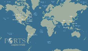
Link to map showing some project locations
Since 1990, Michael has led the hydraulic and scour analyses for more than 3,600 bridges, both existing and proposed, in 28 states and four foreign countries. He led the hydraulic analyses for the design of the following major bridge projects utilizing the latest two-dimensional hydrodynamic model (FESWMS-2DH), conventional hydraulic models (HEC-RAS and WSPRO), and scour evaluation procedures from HEC-18, HEC-20, and HIRE. The hydraulic analyses include the comparison of alternative bridge and approach roadway configurations in order to minimize the potential backwater and the redistribution of flow across the floodplain. The scour evaluations include the estimation of local contraction, pier, and abutment scour as well as long-term erosion. Typical recent projects include:
McKinley/Knapp Street Bridge over the Milwaukee River, Milwaukee County, Wisconsin, including data collection, two-dimensional hydraulic modeling, scour analysis, and design of countermeasures to protect the 96-inch sanitary sewer crossing located adjacent to the proposed bridge piers.
U.S. Route 54/69 Bypass Bridge over Marmaton River, Fort Scott, Kansas, including data collection, hydrologic and hydraulic modeling, scour and head cut analysis, and countermeasure design.
Great River Bridge over the Mississippi River, Desha County, Arkansas to Bolivar County, Mississippi, including the hydraulic modeling, scour analysis, and scour countermeasure design.
U.S. Route 60 over Cane Creek and Goose Creek, Butler County, Missouri, including hydrologic and hydraulic modeling and scour analysis.
Paksey Bridge Construction Project, Ganges River, Paksey, Bangladesh, including data collection, bathymetric surveys, two-dimension hydrodynamic modeling, long-term geomorphic modeling with MIKE 21-C, physical modeling, scour analysis, river training works, and flood control levee design and construction for 15-span concrete highway bridge and 27 kilometers of levees and river training works.
Greater Cairo Metro Tunnel Crossing of Nile River, Cairo, Egypt, including field reconnaissance, bathymetric surveys, two-dimensional hydrodynamic and sediment transport modeling with HEC-6 of 15 kilometer reach of Nile River, and scour analyses of six river crossings and tunnel protection works.
Herbert C. Bonner Bridge carrying NC Route 12 over the Oregon Inlet, including data collection, bathymetric surveys, two-dimensional hydrodynamic modeling, physical modeling, and scour analysis for the main span connecting Pea and Hatteras Islands, in the Outer Banks of North Carolina.
U.S. Route 501 over the Intracoastal Waterway, including wetlands and floodplain analysis, hydraulic analysis, and scour analysis for the main span over the tidal estuary and three separate bridge structures over Socastee Swamp in Horry County, South Carolina.
State Route 105 Bridge over the Waccamaw River, Horry County, South Carolina, including hydraulic analysis for the existing and proposed structures under a no rise criteria imposed by FEMA and comprehensive scour evaluation for both structures. The hydraulic analysis was complicated by the comparison of alternative roadway approaches and substructure configurations.
State Route 15 Bridge over the Housatonic River at Stratford, Connecticut, including scour evaluation of the existing structure using two-dimensional hydrodynamic modeling for conventional flood events during alternative tidal surge conditions.
Canal Parkway over the Potomac River and C&O Canal, including floodplain analysis and delineation, hydraulic analysis, and scour analysis for the main span over the Potomac River and relief span over the C&O Canal in South Cumberland, Maryland.
West Baltimore Street Bridge Rehabilitation over the Gwynn’s Falls, including floodplain analysis, channelization alternatives, guide banks, and scour analysis of the existing three span arch bridge at Baltimore, Maryland.
U.S. 119 over Tug Fork, including four separate bridge crossings near Williamson, West Virginia.
Attaway Road Bridge Emergency Repair, including guide banks, channelization, and additional spans over Gila River in Pinal County, Arizona.
U.S. 231 over Ohio River including the main span and 2.5 miles of approach embankment within the floodplain at Owensboro, Kentucky.
West Virginia Route 4 over the Ohio River including the main span and roadway approaches at New Martinsville, West Virginia.
Seventeenth Street Causeway over the Intracoastal Waterway (Stranahan River) at Fort Lauderdale, Florida.
District-wide Scour Evaluations for the Florida Turnpike Authority including 63 preliminary screenings to determine if scour critical and 14 detailed scour evaluations.
As project hydraulic engineer, Michael Ports led the hydraulic and sediment transport modeling for the design of the permanent protection of the buried aqueduct crossings of the San Luis Rey River for the San Diego County Water Authority. The hydraulic modeling using both HEC-RAS and FESWMS-2DH and the sediment transport modeling using both HEC-6 and FLUVIAL-12 is required to design the protection of the buried aqueducts from scour, assess the long-term impacts on the extensive flood control levee system from sand mining within the river.
Michael was the project manager for the planning and design of the rechannelization of the Salt River in Phoenix, Arizona from Mill Avenue to 40th Street, a total distance exceeding three miles. The new channel design controls the dynamic behavior of the river, provides a corridor for two major freeways, reduces the length of three new bridges, removes developable land from the floodplain, stabilizes old landfills adjacent to the channel, replaces existing low quality riparian habitat, and provides excess material for roadway embankment. The hydraulic analysis required conventional water surface profile computations using HEC-2 and WSPRO, bridge scour and long-term sediment transport modeling using QUALPRO and HEC-6, and two-dimensional hydrodynamic modeling using FESWMS-2DH. The complexity of the project required extensive coordination throughout all phases of the planning and design, with five roadway and bridge design consultants and over fifteen federal, state, and local agencies and utilities. Major project elements include 5.3 miles of levees, 3.7 miles of 72-inch sanitary sewer and water main pipeline relocation, and major recreational and landscaped features, such as bike paths, jogging trails, an urban park, and creation of 50 acres of riparian wildlife habitat.
Mr. Ports was directly responsible for the hydraulic engineering aspects of the design for the Alaska Natural Gas Transportation System. As chief hydraulic engineer, he led the development of the hydrologic, hydraulic, erosion and sediment control, restoration and revegetation, fishery and wildlife habitat mitigation criteria, practices, standards, and specifications for the planning, design, and construction of the 750-mile long, 48-inch diameter buried pipeline from Prudhoe Bay to the Canadian border, including access roads, compressor stations, material sites, disposal sites, camps, airfields, and other appurtenant facilities. More than 500 pipeline stream crossings were designed.
As Project Hydraulic Engineer, Michael performed the hydraulic design and risk analysis for the construction of the Shot Tower Subway Station beneath the Jones Falls in Baltimore, Maryland. The hydraulic analysis was complicated by the fact that the Jones Falls flows through three parallel conduits underneath the central business district of Baltimore City, a total distance of 9,000 feet. A unique approach to the risk analysis coupled the application of the HEC-2 model for overland flows to the EXTRAN hydrodynamic model for pressure flows in the three parallel conduits in order to accurately delineate the flood plain through the project area.
As project manager and chief hydrologist, Michael directed the development of the master plan for drainage improvements for the 98,000-acre New Orleans metropolitan district, an area largely below sea level, protected by levees and served by a 180-mile network of canals with 20 major pumping stations. Development of the master plan required extensive hydrologic and hydraulic modeling using SWMM as well as statistical analysis of hourly rainfall data collected over a 90-year period. An implementation plan was formulated for a 10-year, $500 million capital improvement program that would double the capacity of the entire storm drainage system.
Utilizing the latest in computer simulation techniques, including SWMM, HSPF, HEC-RAS, UNET, and HEC-DSS, Michael Ports has gained extensive and unique experience in the analysis of existing storm drainage and flood control facilities, including levees, canal systems, and pumping facilities, in southern Louisiana. As project hydrologist, Michael performs statistical analysis and computer simulation for projects such as:
• The hydrologic impacts from the construction of oil pipelines, tank battery, docking facilities, and access roads on runoff quality and quantity for the 140-acre Moseley Tract on Avery Island, Iberia Parish, Louisiana.
• To determine the extent and causes of the April 6-7, 1983 storm event and the resultant flooding experienced within the levee system in the Lower Coast Algiers, Orleans Parish, Louisiana.
• The May 1978 and April 1983 storm events in order to determine the extent and causes of the resultant flooding experienced within the levee system of Chalmette, St. Bernard Parish, Louisiana.
• The May 1978, April 1980, and April 1983 storm events in order to determine the extent and causes of the resultant flooding within the leveed portions of Harahan, Jefferson Parish, Louisiana.
Previously, as Chief of the Watershed Management Division, Maryland Water Resources Administration, Micheal was responsible for the State regulatory programs for surface water resources. He was instrumental in the development and implementation of the first state regulatory programs for urban stormwater management, erosion and sediment control, and floodplain and waterway construction. He served as the State Dam Safety Officer and was responsible for the management of the statewide dam safety program. By applying the Universal Soil Loss Equation, Michael developed methodologies for estimating erosion rates and sediment yields on urban and highway construction sites.
Selected projects that illustrate Michael’s experience in hydraulic and hydrologic analysis, water quality modeling, stormwater management, soil erosion and sediment control, and environmental impact assessment include:
Mize Boulevard Lake for the Canyon Creek Project, Lenexa, Kansas, including field reconnaissance, hydrologic and hydraulic modeling, and design for a 30-foot dam impounding an 11-acre reservoir used for stormwater detention, water quality, and aquatic and riparian habitat enhancement.
Quality Assurance Evaluation and Peer Review of the Storm Water Management/Fluid De-Icing Issues at Dayton International Airport, including background data collection, airport briefing and field reconnaissance, project review meeting and analysis, and summary project review report and presentation.
Overbrook Stormwater Management Plan, Norfolk, Virginia. As project hydrologist, directed the development of the stormwater management plan for the 150-acre watershed, including catchment modeling using SWMM, assessment of baseline conditions, formulation of alternative flooding solutions, and preliminary design of the preferred alternative.
Hughes Aircraft Company NPDES Permit, Tucson, Arizona. As project hydraulic engineer, directed the characterization of the stormwater runoff from the plant site using HSPF and designed a field screening and flow monitoring program for the plant site.
Stormwater Retrofit of Major and Minor Outfalls in Redhouse Run Watershed, Baltimore County, Maryland. As principal investigator, directed the watershed study to assess the need for and feasibility of implementing stormwater BMPs. The study included a detailed field reconnaissance and survey to identify potential sites for new or retrofitted BMPs. The survey included an analysis of the existing conditions, sources of erosion and water quality problems, and drainage system deficiencies.
Arizona Department of Transportation NPDES Permit Support, Pima County, Arizona. As project hydraulic engineer, directed the summarization of storm drainage data, preparation of storm drainage facilities mapping, characterization of storm-water runoff using HSPF, and implementation of field screening program for the constructed portions of all ADOT facilities in Pima County.
49th Street Bridge over Tampa Bay and Approaches, Pinellas County, Florida. As project hydraulic engineer, performed preliminary analysis and final design for proposed stormwater management facilities for both runoff water quantity and quality control, including infiltration, extended detention, and sediment control.
Dorsey Road Park and Ride Facility, Anne Arundel County, Maryland. Provided quality assurance reviews for designs of proposed runoff water quantity and quality control facilities, including detention and erosion control.
Tucson International Airport and Ryan Field, Stormwater Pollution Prevention Plans and Spill Prevention, Control, and Countermeasure Plan, Tucson, Arizona, including background data collection, field reconnaissance, environmental audits and interviews for all owner and tenant operations at both facilities. Special emphasis was placed on the application of cost effective BMPs into ongoing airport operations.
Hopkins International Airport, Cleveland, Ohio. As chief hydrologic and hydraulic engineer, prepared appropriate sections of environmental assessment for the proposed runway extension, which was complicated by the presence of wetlands and floodplains and the necessity to conform to the NPDES stormwater permitting requirements.
Rosedale Park and Ride Facility, Baltimore County, Maryland. Provided quality assurance reviews for designs of proposed runoff water quantity and quality control facilities, including detention and erosion control.
White Marsh Park and Ride Facility, Baltimore County, Maryland. Provided quality assurance reviews for design of proposed runoff water quantity and quality control facilities, including detention and erosion control.
Continuous Electron Beam Accelerator Facility, Newport News, Virginia. As project hydraulic engineer, designed stormwater drainage systems for water quantity and quality control, including detention and erosion control.
Air Force One Maintenance and Support Complex, Andrews Air Force Base, Maryland. As project hydraulic engineer, designed stormwater drainage systems for water quantity and quality control, including infiltration, extended detention, filtration, and erosion and sediment control.
College Park Metro Station, College Park, Maryland. As project hydraulic engineer, designed stormwater drainage system, including infiltration facilities, for both water quantity and quality control, and erosion and sediment control.
Greensville Multiple Facility Prison Complex, Jarrett, Virginia. As deputy project manager and project hydraulic engineer, responsible for overall civil engineering and site work and storm drainage designs, including stormwater management for water quantity and quality control, and for erosion and sediment control.
Hydrologic Investigation of the Wolfswinkel Tract, Phoenix, Arizona. As project hydrologist, performed flood plain delineations to determine the developable portion of 150-acre tract.
American Public Works Association, Chicago, Illinois, senior technical advisor on research project Nationwide Characterization, Impacts and Critical Evaluation of Storm-water Discharges, Combined Sewer Overflows, and Non-Sewered Urban Runoff.
